A Cooperative Ocean Observing Product
Transforming raw information into impactful, real-world tools.
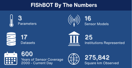
FIShBOT was built to increase access to observations of underwater conditions collected by both fishing and science communities. All bottom data are standardized into a gridded dataset and updated every 24 hours.
Temporal Range: 2000-01-01 – Present
Spatial Domain: Western Gulf of Maine to Cape Hatteras
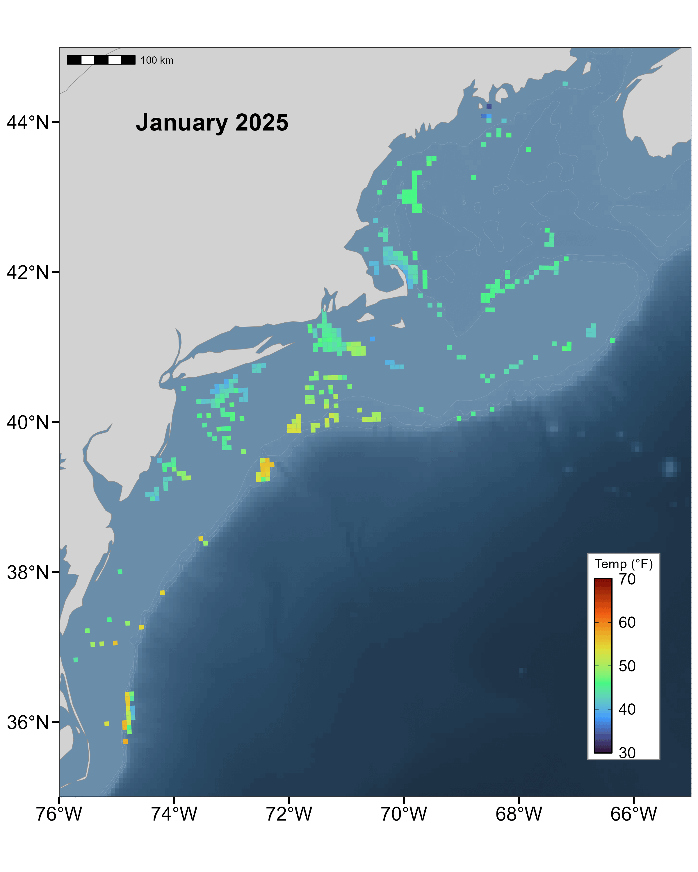
FiShBOT Bottom Temperature (February 2025)
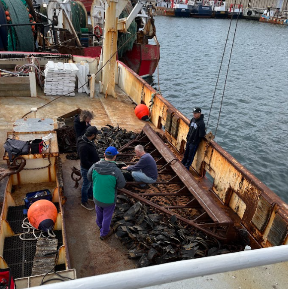
(L-R) Farrell Davis and Samir Patel (Coonamessett Farm Foundation), Huanxin Xu (Gulf of Maine Lobster Foundation), Captain Peter Barcz and Rio Ypon (F/V Atlantic) discuss placement of a sensor on a scallop dredge in New Bedford, MA. Photo credit: NOAA Fisheries
What data does FIShBOT provide?
Researchers and the fishing community alike share the need to better understand and monitor ocean conditions in our dynamic region. FIShBOT data comes directly from sensors that measure:
 Temperature
 Salinity
 Dissolved Oxygen
Where can you find FIShBOT?
You can find us in lots of places!
Our ERDDAP Data Server
Users can generate maps for any area on any given day. You can also download the data here!
Cape Cod Ocean Watch Data Portal
FishBOT is a layer you can add on to the map for any given date!
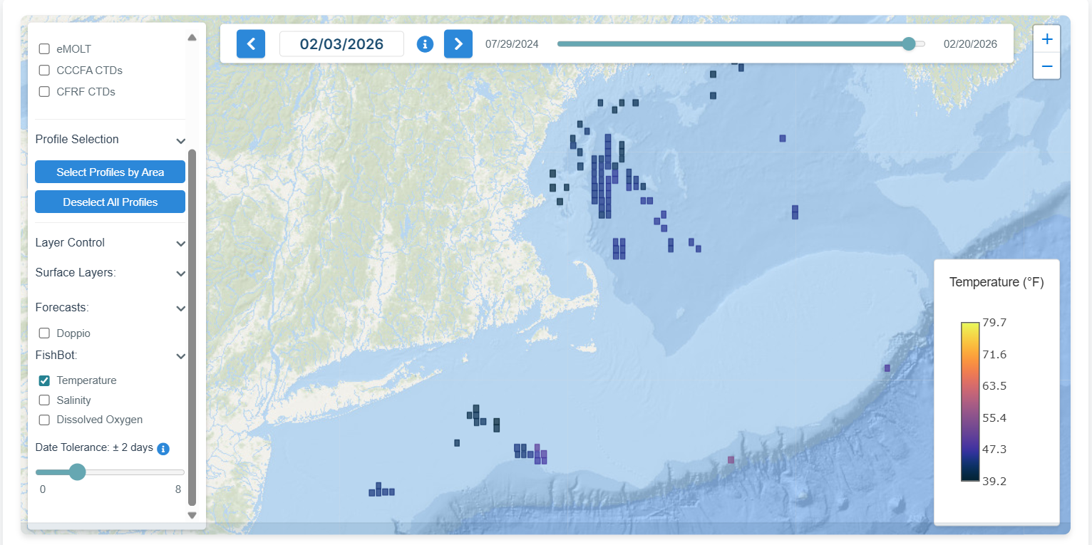
Cape Cod Ocean Watch Data Portal: An interactive tool by Woods Hole Oceanographic Institution